Geodetics Point&Pixel
Geo-MMS LiDAR and Geo-Photomap utilize very different sensors and techniques for UAV mapping. Geo-MMS LiDAR directly geo-references LiDAR data to provide accurate and near real-time 3D point clouds. Geo-Photomap directly geo-references camera images to provide 3D point clouds in a traditional post-processing photogrammetry process. Several studies have been conducted comparing these two techniques, however, most studies have been focused on accuracy assessment rather than determining the appropriate technology – UAV LiDAR (LiDAR Points) or UAV photogrammetry (Pixels) for mapping an area with specific characteristics. For example, it is best to use UAV LiDAR when mapping an area with dense tree canopy, mine site conveyors, modeling narrow objects such as transmission lines, pipes, sharp-edge features, and fields of rocks (aggregates). When mapping bare earth mine sites, earth work projects, and other areas that are not occluded by trees, buildings, or equipment using UAV drone Photogrammetry is best.
To illustrate the differences, we processed a site using both Geo-MMS LiDAR and Geo-Photomap products. Figure 1 shows the solutions obtained from the two products side-by-side.
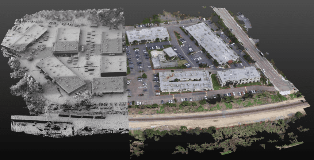
Figure 1: Mapping Using Geo-MMS LiDAR (left) and Geo-Photomap (right)
A closer look shows that with LiDAR by itself it is more difficult to classify objects than with the colored Geo-Photomap photogrammetry approach, while photogrammetry by itself has difficulty handling areas covered in foliage and low vertical accuracy where LiDAR shines.
Geodetics’ approach to overcome the limitations illustrated above is to blend the point clouds from the Geo-MMS LiDAR with the point clouds from Geo-Photomap providing the best of both approaches see Figure 2.
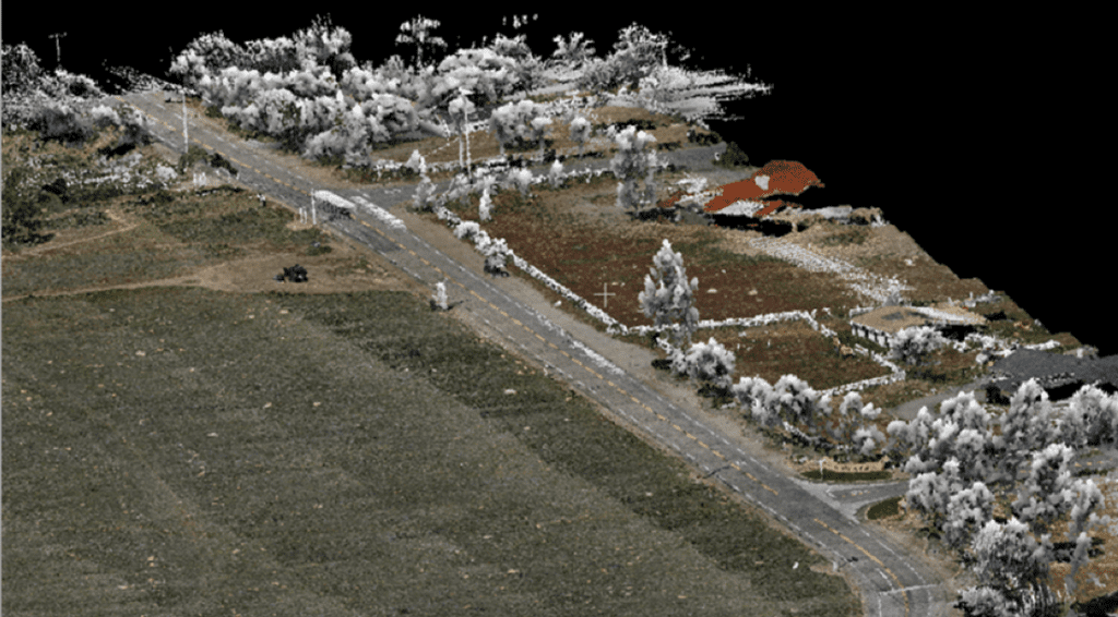
Figure 2: Integration of Point Cloud from Geo-MMS LiDAR and Geo-Photomap
Introducing Geodetics Point&Pixel product specifically created to provide tight-integration between LiDAR and photogrammetry sensors offering the best of both.
The advantages Point&Pixel solution include:
- Combines LiDAR and Photogrammetry (RGB/multispectral) point clouds
- Enhance visualization
- Enables LiDAR point cloud colorization
- Enhance DTM/DEM Extraction
- Facilitate LiDAR point cloud classification
- Orthophoto generation in areas that Photogrammetry fails (i.e., glaciers, tree canopy, mine site conveyors, etc.)
- Change detection (2D, 3D, 4D)
Figure 3: Point&Pixel Product
Learn more about Geodetics UAV drone product suite Geo MMS LiDAR, Geo PhotoMap and Point&Pixel.
