Utilizing Geo-Photomap Multi-Spectral Sensors in Precision Agriculture
Geodetics’ new drone for photogrammetry Geo-Photomap is a new technology offered in the Geo-MMS Drone LiDAR Mobile Mapping System product suite. Geo-PhotoMap tightly integrates GPS/IMU with RGB imagery resulting in direct-georeferencing of the captured images, allowing the capability of precision agriculture. It is now available with multi-spectral sensors. With Geo-Photomap, the change from RGB to multi-spectral is as simple as Plug&Play of the camera lens, as shown below. By turning CE DSLR cameras into high-end multi spectral sensors with NDVI & Red Edge Lens technologies, Geo-Photomap becomes an ideal tool for advanced precision agriculture applications.
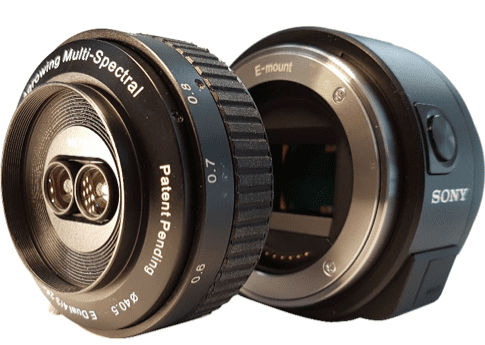
Figure 1: Geodetics Geo-Photomap Multi-Spectral Sensor Camera Lens
Similar to the how RGB images are captured and time-tagged with Geo-Photomap, multi-spectral images are also time-tagged and geo-tagged. The geo-referenced images are then post-processed, generating an accurate and precise orthomosaic without the use of ground control points (GCP-free). This new drone for photogrammetry Geo-Photomap capability supports many new applications, including agriculture (canopy classification), forest planning and management (fire, precision forestry), environmental assessment, ecological & land Classification, etc. Photogrammetry, can generate full-color 3D and 2D models (in the various light spectrum) of the terrain that is easier to visualize and interpret.

Figure 2: NDVI Images and Vegetation Index
Geodetics now offers a full array of Geo Mobile Mapping Systems (MMS) customized to meet the needs of several industries including but not limited to precision agriculture, road mapping, quarry mapping, forestry, surveying and more. From Drone LiDAR Geo-MMS direct georeferencing to Geo-Photomap with DTM/DSM extraction and spectral analyzing to Point&Pixel that combines LiDAR and camera direct-georeferencing. Point&Pixel is a new capability offered with Geodetics’ Geo-MMS, integrating LiDAR point clouds with RGB imagery resulting in stunning colorized point clouds. Each product offering can be customized for any project or need. Request more information below.
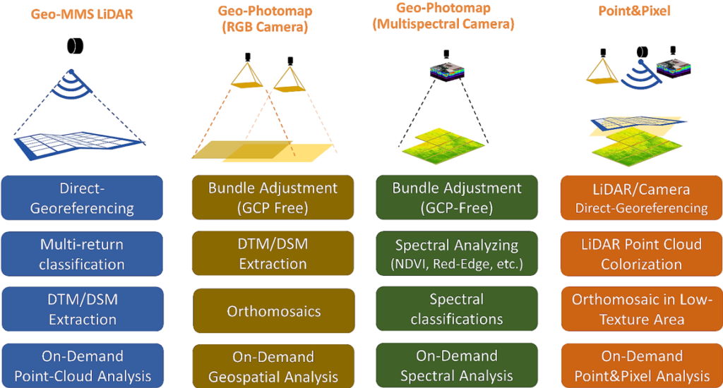
Figure 3: Geo-MMS family of products
