Geodetics’ LiDAR 3D Drone for Design, Mapping, & Maintenance of Solar Farms
Geodetics’ Geo-MMS LiDAR 3D Drone mobile mapping system, offers a quick and cost-effective tool for all phases of solar system deployment, from solar farm design, to solar farm mapping and maintenance. The solar industry has grown exponentially in the last ten years, up 59% since 2006. In just 3 years solar has accounted for at least 30% of new electricity capacity. With the increased demand, solar farm development has become an active field in municipality projects where solar farms are built on large sites. Accurate location and angle of each solar panel is critical for optimal power generation.
Geodetics’ Geo-MMS LiDAR Drone 3D mobile mapping system is ideal for mapping solar farms. Utilizing its “One Click” software, data processing takes less than 30 minutes when in the field. A single Geo-MMS LiDAR flight can cover up to 100 acres. Several companies are already leveraging Geodetics’ technology and seeing a significant impact on their company’s accuracies and efficiencies.
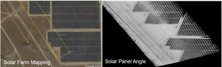
Geodetics LiDAR 3D Drone enables accurate planning and layout for solar farms.
Geodetics’ Geo-MMS LiDAR mapping application can be extended into industrial mapping of solar panels, where an accurate alignment of individual solar panels is vital (shown below). Flying at low altitude and speed provides sufficient LiDAR point density for accurate infrastructure alignment.
Geodetics LiDAR 3D Drone assists in accurate alignment of individual solar panels to ensure optimal output.
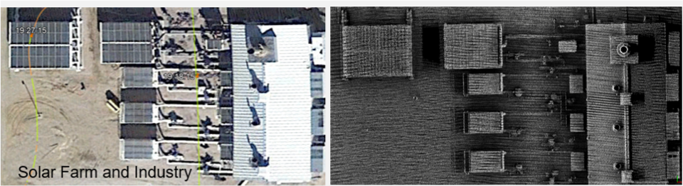
In addition, Geo-MMS 3D Drone LiDAR technology can be applied to mapping rooftops for solar installations where an accurate shape, surface, and angle of individual rooftops is needed for installation in order to determine the calculation of the potential solar energy contribution of each building in a site. This enables companies to accurately place their solar panels for optimal sun exposure providing the greatest output.
LiDAR 3D Drone mapping allows for accurate solar farm mapping on roof tops.
