First Responders Quickly Adopt LiDAR Drones for Emergency Situations
When it comes to emergency situations, first responders require agile real-time solutions which has led to first responders and drone usage increasing year over year. A real-time 3D map can provide a vital source of information for management and decision-making during such emergencies like wildfires, accidents, hurricanes and other search & rescue operations. In these emergency situations, every second counts and could be the difference of saving or losing a life. For this reason, fire-fighters are quickly adopting the use of LiDAR drones like Geodetics Geo-MMS LiDAR system for real-time mapping.
LiDAR Drones are being sent to fire locations as scouts, using sensors and cameras with thermal imaging technology to help first responders in their rescue efforts. By leveraging drones like Geodetics Geo-MMS LiDAR drone firefighters are able to quickly assess emergency situations, determine where the hottest spots are and identify rescuable fire victims in a matter of minutes. What used to take 10 to 15 minutes for fire fighters to assess now takes just 2 to 3 minutes. They are able to act quickly, save more lives and structures. First responders and drone operation adoption is key to limit casualties in emergency situations.
The Geo-MMS LiDAR, equipped with the Velodyne VLP-32C laser scanner, can cover an area up-to 250 acres in a single flight. This type of area coverage is enough to provide an initial assessment of the emergency situation. Additional flights can be used for change detection and 4D examination.
In addition to 3D geo-referenced LiDAR point clouds, LiDAR intensity is a reliable source for data analysis and decision-making. Recently, a team of fire-fighters in Ecuador, shown in the Figure 1 (below) operated the Geo-MMS LiDAR system for training and data acquisition as shown in Figure 2.
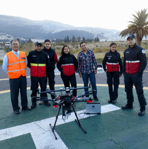
Firefighters Using a LiDAR Drone in Ecuador
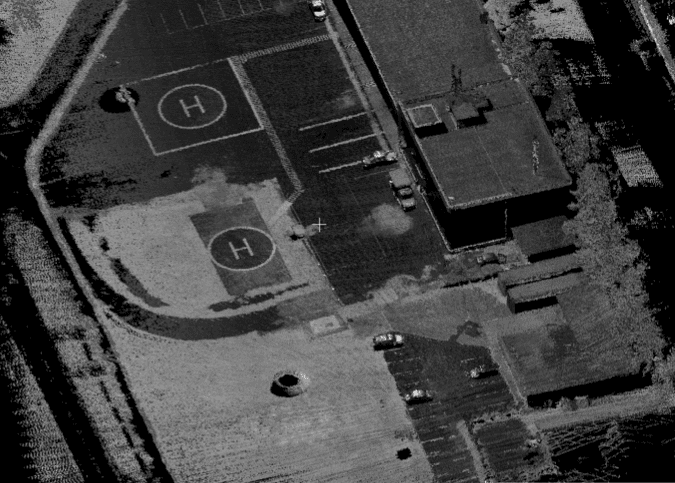
Geo-MMS LiDAR Drone Image
Thermal imagery is an advanced feature of Geodetics Geo-MMS LiDAR drone used by first-responders. Currently, most existing thermal mapping systems use thermal data in video form where users must rely on their knowledge of the environment in order to geo-locate data. Geo-locating the thermal imagery will enable the first responder to overlay the LiDAR point cloud with the thermal images providing a true 3D view of the thermal environment. Request more information to learn more.
