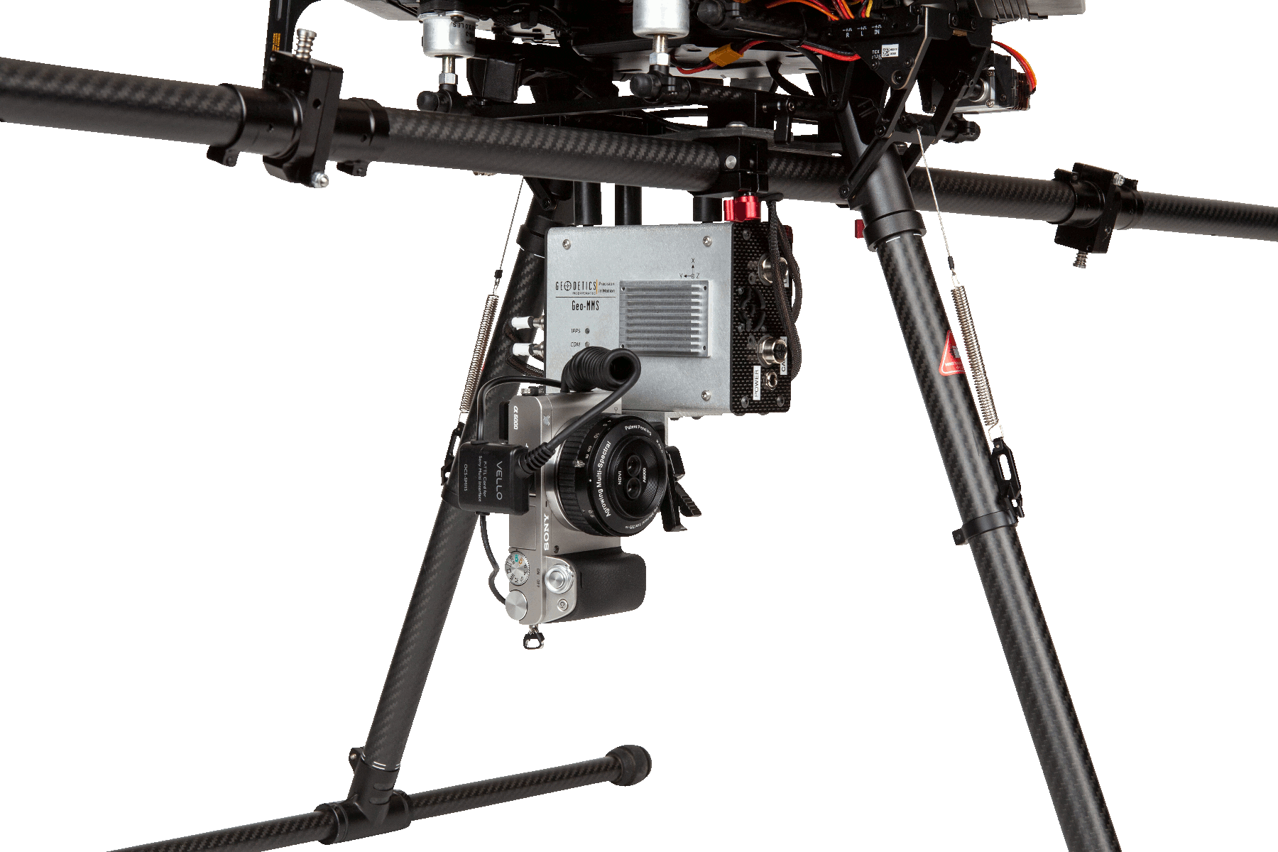
GCP-Free Drone Photogrammetry System
Geo-Photomap is a new technology and capability offered by Geodetics’ Geo-MMS LiDAR Mobile Mapping System. Geo-Photomap tightly integrates GPS/IMU with RGB imagery/multispectral resulting in direct-georeferencing of the captured images, allowing the capability of corridor mapping and vertical mapping:
- Image Time-tagging
- Image Geo-tagging
- Ground Control Point Free
- Allows vertical mapping
- Allows corridor mapping (low sidelap)
- Camera rotation capability
- Facilitates Photogrammetry Process
- Reduce flight duration (less overlaps)
- Supported by Agisoft, Pix4D, etc
- Rasterization
- Orthophoto generation
- Ready to use along Geodetics’ LiDAR module (Point& Pixel)
Size / Weight / Power
- 58.5 in3(6.3 x 3.9 x 2.4) / 20 oz., 14 – 30 VDC @ 20 Watts min. (excluding camera size and weight)
Temperature Range
- Specified: -20°C to +65°C | Operating: -40°C to +70°C.
Interfaces
- External power connector, QMA GPS antenna connector, 1 Ethernet data port, External access to SD card, power switch, RF RPSMA connector, 4 status LEDs.
Real-Time Data Output
- Available via Ethernet (on the bench) and up to 25Hz. via Radio (in flight), Solution Latency – 16 microseconds 1δ.
Data Recording/Logging Navigation solutions
- Navigation solutions recorded at 125 Hz, including raw GPS & IMU data (for post-processing).
Web User Interface
- (status, configuration, log, SW update).
- UAV Photogrammetry (GCP-free)
- Vertical mapping
- Corridor mapping
