Geodetics Provides Images with Attitudes
In the world of UAV Photogrammetry, the Aerotriangulation (AT) or the bundle adjustment is defined simultaneously refining the 3D model of captured images, estimating the camera position/attitude, and calibrating the camera.
To generate high-accuracy 3D models, AT is usually performed in two stages: (1) create a local 3D model, and (2) transfer the local 3D model into the object space using surveyed ground control points (GCP). Creating a local 3D model is based on an image modeling technique that allows the creation of dense 3D point cloud models from images. This technique has been improved over recent years by leveraging computer vision techniques. Surveying GCPs is most difficult part of an AT project as the ground team must carefully plan the proper distribution of GCPs around the perimeter of the area of interest automated optical inspection (AOI) and survey them. Additionally, flight planning should be designed so that the flight strips ensure GCP coverage with sufficient overlap to enable finding tie points. If for any reason, these two steps are not performed properly, the solution will not be clean. In many projects, the distribution of the GCPs on the AOI is easy on paper but surveying them might not be feasible e.g. high cliffs, private boundaries etc. In projects including corridor mapping and vertical mapping, a strong distribution of the GCPs is also not feasible. For example, in a vertical mapping e.g. cell tower, the images are captured horizontally, and thus, because there is no “ground” behind the tower, it is nearly impossible to place GCP’s. In a corridor mapping, similar problems exist as it is difficult to achieve a strong distribution of GCPs along a long straight corridor with only a few flights passes.
To overcome these challenges, Geodetics developed its Geo-Photomap product, see Figure 1. With the Geo-Photomap, we can capture “images with attitude”. Image attitude includes precise time-tagged and geo-tagged data obtained through the use of a high-performance GPS aided inertial navigation system. With accurate position and attitude of the images, AT can be performed purely with the image data without the need of GCP’s. In fact, each image’s projection center is now represented as a “GCP in the air”. This capability reduces the sidelap (separation between the strips) required for AT to less than 20%. By increasing the flight line separations, the number of images required to cover the AOI will be decreased. Thus, by reducing the flight duration and number of images, the processing time will be dramatically reduced.
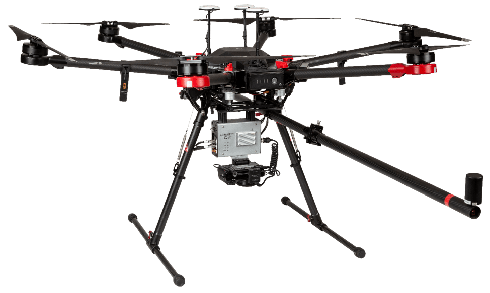
Figure 1: Geo-Photomap Turn-Key System
The high-performance dual-antenna GPS aided inertial navigation system used in Geo-Photomap, provides an accurate PPK trajectory path. A hot-shoe link on the camera is used to time-tag the captured images and processing software interpolates image exposure time from the trajectory path and updates the image EXIF headers with the geo-tagging data. Several cameras are compatible with Geo-Photomap including the Sony a6000, a6300, and a7R. To change the camera orientation from nadir direction (for regular uav photogrammetry mapping) to the vertical direction (for vertical mapping) or change the RGB lens to multispectral lens is just a matter of Plug&Play in the Geo-Photomap, as shown in Figure 2.
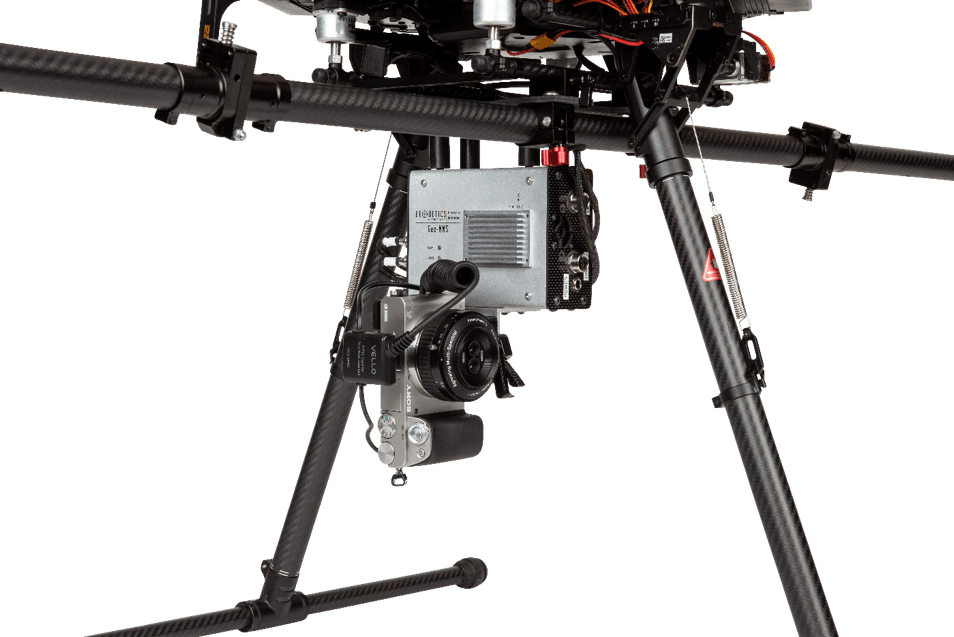
Figure 2: Geo-Photomap Mounted on the DJI 600 Pro with Multispectral Lens in Vertical Mode
The other advantages of Geo-Photomap include:
- GCP free uav photogrammetry
- Image time-tagging and geo-tagging
- Provide Exterior Orientation Parameters (Omega, Phi, Kappa)
- Rotating mounting for horizontal/vertical mapping
- Moving from flat orthomosaic to 3D map
- Reduced Overlap
- Increase mapping coverage
- Single crew operation
- Ready to use along Geodetics’ LiDAR module (Point& Pixel)
Discover what makes Geodetics product suite superior to the rest and how Geo-Photomap has enhanced UAV photogrammetry to increase efficiencies. Request more information
