GPS-MMS UAV Defense
The US military is expanding it’s uav defense strategies, turning to logistical purposes by expanding their abilities to defend against their enemies. In recent years, drones have become an integral part to government agencies as they have managed to maneuver unreachable areas. From quick land surveillance to scanning an unreachable military bases, drones are proving to be extremely beneficial in places where man cannot reach or is unable to perform in a timely and efficient manner.
Geodetics expands their mobile mapping product portfolio by developing an UAV drone with emphasis on requirements vital for the defense industry:
- Heavy-lift U.S. made drone
- SAASM/M-Code Navigation module
- Long-range operation (200m)
- Navigator module can be upgraded to GPS-Denied Module
- Day/Night operational capability (LiDAR and Camera)
- Camera (RGB, multispectral, hyperspectral)
- GCP-Free Photogrammetry (on-the-air GCPs)
- Expendable to more sensors, including thermal camera
- Configurable for more sensor data, such as gas/leak detection sensor, bathymetry, etc.
- Recording enable/disable option
- Agile assembly
- Hybrid engine (Gas, Battery)
- No static/dynamic alignment required
- Real-time (LiDAR) and Near real-time (Camera) 3D model
- Minimum crew operation
- Ease of service, use, and data processing
- ‘One Click’ software available on the Toughbook laptop
All of the industry-leading Geo-MMS capabilities for our Defense customers with heavy-lift U.S. made drones and SAASM/M-Code compliance, see Figure 1.
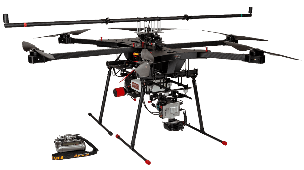
Figure 1: Geo-MMS Defense Module
Learn more about Geodetics defense support background and the customizable UAV Drone mobile mapping system products in their portfolio. Request more information today.
